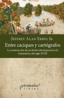
Entre caciques y cartógrafos: La construcción de un límite interimperial en la Sudamérica del siglo XVIII. Traducido por Emilia Ghelfi. Ciudad Autónoma de Buenos Aires: Prometeo Libros, 2022 (detalles)
A finales del siglo XVIII Portugal y España enviaron expediciones cartográficas conjuntas para trazar un límite de casi 16.000 kilómetros entre Brasil y la Sudamérica española. Estas expediciones fueron las más grandes enviadas a Sudamérica y coincidieron con reformas imperiales en todo el continente.
Este libro examina la interacción entre los imaginarios espaciales imperiales e indígenas, yendo más allá de los marcos analíticos que evalúan los límites mapeados estrictamente a través de la ley colonial o de la soberanía indígena. El resultado es una intrincada historia de la creación de un límite geográfico entre lo que hoy es Argentina, Brasil y Uruguay, que tuvo, y tiene, implicaciones globales. A partir de manuscritos provenientes de archivos históricos de siete países, Jeffrey Erbig rastrea las interacciones entre colonos iberoamericanos, habitantes de las misiones jesuíticas guaraníes y pueblos indígenas autónomos de la región. Demuestra que, al responder activamente al trazado cartográfico, los indígenas reivindicaron sus propios reclamos territoriales y la conformación de una frontera dependía de su participación y de su autoridad.
- Entrevista sobre Entre caciques y cartógrafos (Revista Ñ)
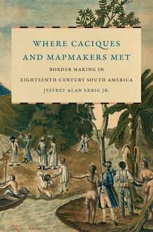
Where Caciques and Mapmakers Met: Border Making in Eighteenth-Century South America. Chapel Hill: University of North Carolina Press, 2020 (available here)
During the late eighteenth century, Portugal and Spain sent joint mapping expeditions to draw a nearly 10,000-mile border between Brazil and Spanish South America. These boundary commissions were the largest ever sent to the Americas and coincided with broader imperial reforms enacted throughout the hemisphere. Where Caciques and Mapmakers Met considers what these efforts meant to Indigenous peoples whose lands the border crossed. Moving beyond common frameworks that assess mapped borders strictly via colonial law or Native sovereignty, it examines the interplay between imperial and Indigenous spatial imaginaries. What results is an intricate spatial history of border making in southeastern South America (present-day Argentina, Brazil, and Uruguay) with global implications.
Drawing upon manuscripts from over two dozen archives in seven countries, Jeffrey Erbig traces on-the-ground interactions between Ibero-American colonists, Jesuit and Guaraní mission-dwellers, and autonomous Indigenous peoples as they responded to ever-changing notions of territorial possession. It reveals that Native agents shaped when and where the border was drawn, and fused it to their own territorial claims. While mapmakers' assertions of Indigenous disappearance or subjugation shaped historiographical imaginations thereafter, Erbig reveals that the formation of a border was contingent upon Native engagement and authority.
Reviews of Where Caciques and Mapmakers Met
- American Historical Review
- The Americas
- Bulletin of Latin American Research
- Choice Connect
- Colonial Latin American Review
- Early American Literature
- Journal of Latin American Geography
- Hispanic American Historical Review
- Historical Geography
- H-LatAm
- H-Maps
- Imago Mundi
- Journal of Early American History
- Journal of Jesuit Studies
- Journal of Social History
- The Latin Americanist
- Tempo
"Afterlives in Captivity: Indigeneity and Penal Deportation in Southeastern South America," Atlantic Studies, 2023 (download)
Abstract: This study analyzes intersections between penal deportation and Indigenous captivity in southeastern South America during the eighteenth century. Via records on Lincompani, a cacique taken captive in the southern borderlands of Buenos Aires and exiled to the Malvinas Islands alongside other prison laborers (presidiarios), it highlights the scale of penal deportation within the early Americas and connects the practice to the formation of geopolitical borders. As colonial officials banished purported criminals to borders, rather than across them, and banished male Indigenous captives from one borderland to another, these forced migrations reinforced territorialized spatial logics and contributed to Indigenous land dispossession. Drawing upon a half century of records from Malvinas, the article also analyzes convicts' and captives' experiences of penal deportation, highlighting instances when their shared status as presidiario may have superseded or been subordinated to ethnic distinctions, considering the gendered logics that shaped their banishment, and reflecting upon the narration of their actions via colonial records.
Abstract: This study analyzes intersections between penal deportation and Indigenous captivity in southeastern South America during the eighteenth century. Via records on Lincompani, a cacique taken captive in the southern borderlands of Buenos Aires and exiled to the Malvinas Islands alongside other prison laborers (presidiarios), it highlights the scale of penal deportation within the early Americas and connects the practice to the formation of geopolitical borders. As colonial officials banished purported criminals to borders, rather than across them, and banished male Indigenous captives from one borderland to another, these forced migrations reinforced territorialized spatial logics and contributed to Indigenous land dispossession. Drawing upon a half century of records from Malvinas, the article also analyzes convicts' and captives' experiences of penal deportation, highlighting instances when their shared status as presidiario may have superseded or been subordinated to ethnic distinctions, considering the gendered logics that shaped their banishment, and reflecting upon the narration of their actions via colonial records.

"Despolitización a través de la naturalización: Félix de Azara y los pueblos indígenas en el Río de la Plata y Paraguay" Boletín Americanista, no. 84 (2022): 105-126 (descargar)
Resumen: Las obras de Félix de Azara han sido unas de las principales fuentes coloniales para la etnohistoria en el Río de la Plata y Paraguay, pero también han contribuido a la despolitización indígena en los imaginarios coloniales y poscoloniales. El presente artículo compara la carrera de Azara en la región con el contenido de su historia natural. Demuestra que, mientras que Azara buscó la desposesión o la desaparición indígena en sus labores y sus obras, sus escritos también revelan acciones políticas de agentes indígenas que no encajaban en la lógica naturalista.
Resumen: Las obras de Félix de Azara han sido unas de las principales fuentes coloniales para la etnohistoria en el Río de la Plata y Paraguay, pero también han contribuido a la despolitización indígena en los imaginarios coloniales y poscoloniales. El presente artículo compara la carrera de Azara en la región con el contenido de su historia natural. Demuestra que, mientras que Azara buscó la desposesión o la desaparición indígena en sus labores y sus obras, sus escritos también revelan acciones políticas de agentes indígenas que no encajaban en la lógica naturalista.
Still Turning toward a Cartographic History of Latin America,” with Brian Bockelman, History Compass 18, e12617 (2020): 1-15. (download)
Abstract: Since the 1990s, scholars of Latin America have rediscovered maps as historical documents and mapping as a historically significant social practice. Inspired in part by theoretical developments in the broader history of cartography, particularly the notion of maps as cultural texts embedded in sociopolitical contexts that shape their production and meaning, cartographic histories of the region have flourished in recent decades, leading some to herald this development as a new direction in Latin American historiography. This essay examines the emergence and principal trends of this body of scholarship, assessing its contributions and limitations. Taking a broad approach that examines studies of both the colonial and modern periods from Patagonia to the Rio Grande, it argues that while critical map histories have transformed earlier notions of cartographic sources and deepened our understanding of traditional subjects such as colonialism and nation-building, they have yet to reach their full potential. More dialog between scholars in this emerging subfield, more reflection on the spatial assumptions that undergird Latin American history as a whole, and more attention to the diversity of maps available for study are needed to enhance the conceptual contributions of Latin American cartographic history and to expand its visibility both inside and outside the region.
Abstract: Since the 1990s, scholars of Latin America have rediscovered maps as historical documents and mapping as a historically significant social practice. Inspired in part by theoretical developments in the broader history of cartography, particularly the notion of maps as cultural texts embedded in sociopolitical contexts that shape their production and meaning, cartographic histories of the region have flourished in recent decades, leading some to herald this development as a new direction in Latin American historiography. This essay examines the emergence and principal trends of this body of scholarship, assessing its contributions and limitations. Taking a broad approach that examines studies of both the colonial and modern periods from Patagonia to the Rio Grande, it argues that while critical map histories have transformed earlier notions of cartographic sources and deepened our understanding of traditional subjects such as colonialism and nation-building, they have yet to reach their full potential. More dialog between scholars in this emerging subfield, more reflection on the spatial assumptions that undergird Latin American history as a whole, and more attention to the diversity of maps available for study are needed to enhance the conceptual contributions of Latin American cartographic history and to expand its visibility both inside and outside the region.
“Across Archival Limits: Colonial Records, Changing Ethnonyms, and Geographies of Knowledge,” with Sergio Latini, Ethnohistory 66, no. 2 (2019): 249-273 (download)
Abstract: This article examines relationships between archival records produced in borderland spaces and the histories of autonomous (non-subjugated and non-missionized) Indigenous peoples. Focusing on the Banda Oriental region of Southeastern South America, it argues that the geographical content, dispersion, and curation of colonial records have served to silence Native pasts. As Portuguese, Spanish, and Jesuit administrators sought possession of this borderland, they overstated the reach of their own settlements and strategically ascribed ethnic labels to Indigenous neighbors to appropriate their lands or delegitimize their sovereignty. The geographical dispersion of colonial records over time has masked the inconsistencies of such claims, and colonial ethnogeographic imaginations thus persist. By reading colonial sources from multiple settlements against one another, this article identifies contradictions in the geographic and ethnographic information they provide, laying a foundation for new ethnogeographic imaginations that center the spaces and agency of autonomous Indigenous communities.
Abstract: This article examines relationships between archival records produced in borderland spaces and the histories of autonomous (non-subjugated and non-missionized) Indigenous peoples. Focusing on the Banda Oriental region of Southeastern South America, it argues that the geographical content, dispersion, and curation of colonial records have served to silence Native pasts. As Portuguese, Spanish, and Jesuit administrators sought possession of this borderland, they overstated the reach of their own settlements and strategically ascribed ethnic labels to Indigenous neighbors to appropriate their lands or delegitimize their sovereignty. The geographical dispersion of colonial records over time has masked the inconsistencies of such claims, and colonial ethnogeographic imaginations thus persist. By reading colonial sources from multiple settlements against one another, this article identifies contradictions in the geographic and ethnographic information they provide, laying a foundation for new ethnogeographic imaginations that center the spaces and agency of autonomous Indigenous communities.
“Borderline Offerings: Tolderías and Mapmakers in the Eighteenth-Century Río de la Plata” Hispanic American Historical Review 96, no. 3 (2016): 445-480 (download | digital map component)
Abstract: During the second half of the eighteenth century, Portugal and Spain commissioned two mapping expeditions to determine a border between Brazil and Spanish viceroyalties, agreeing for the first time to define territorial possession through collaborative cartographic efforts. These efforts were mediated by autonomous Indigenous communities, who asserted their own land claims. This article explores this dynamic at the borderline’s southernmost portion, an area corresponding to present-day Uruguay, northeastern Argentina, and southern Brazil. I argue that Native peoples known as Charrúas and Minuanes appropriated imperial border-making efforts for their own purposes. As royal officials sought to materialize a border in lands that they did not effectively control, they solicited native agents’ support. In response, Charrúas and Minuanes took up arms, crisscrossed the border to develop informal economies or elude imperial armies, or sought to incorporate new settlers into indigenous sociopolitical networks. These actions undermined imperial designs yet made the border a meaningful form of territorial organization.
Abstract: During the second half of the eighteenth century, Portugal and Spain commissioned two mapping expeditions to determine a border between Brazil and Spanish viceroyalties, agreeing for the first time to define territorial possession through collaborative cartographic efforts. These efforts were mediated by autonomous Indigenous communities, who asserted their own land claims. This article explores this dynamic at the borderline’s southernmost portion, an area corresponding to present-day Uruguay, northeastern Argentina, and southern Brazil. I argue that Native peoples known as Charrúas and Minuanes appropriated imperial border-making efforts for their own purposes. As royal officials sought to materialize a border in lands that they did not effectively control, they solicited native agents’ support. In response, Charrúas and Minuanes took up arms, crisscrossed the border to develop informal economies or elude imperial armies, or sought to incorporate new settlers into indigenous sociopolitical networks. These actions undermined imperial designs yet made the border a meaningful form of territorial organization.
“Between Ethnonyms and Toponyms: Cartography and Native Pasts in the Eastern Río de la Plata,” in Prado, Fabrício, Viviana Grieco, and Alex Borucki, eds., Río de la Plata: From the Seventeenth through the Nineteenth Century, New York: Palgrave Macmillian (2021): 9-30 (download | full book)
Abstract: During the past three decades, historians of cartography and ethnohistorians alike have drawn upon historic maps to examine the spatial practices of Indigenous Americans. This paper builds upon this scholarly impetus by exploring the cartographic representation of autonomous (non-subjugated, non-missionized) Native peoples as free-floating textual ethnonyms. Drawing upon a corpus of 177 historic maps of southeastern South America (Uruguay, northeastern Argentina, and southern Brazil) from the sixteenth through the nineteenth centuries, it demonstrates that each map employed one of a thirteen distinct patterns of locating autonomous Native peoples in the region. These ethnogeographical renderings in turn shaped understandings of Native societies both by their colonial contemporaries and by post-colonial historians. By articulating such representative forms and by comparing them to the ethnic geographies evident in textual sources, this paper sheds light on the interplay between ethnographic and cartographic knowledge in early Latin America.
Abstract: During the past three decades, historians of cartography and ethnohistorians alike have drawn upon historic maps to examine the spatial practices of Indigenous Americans. This paper builds upon this scholarly impetus by exploring the cartographic representation of autonomous (non-subjugated, non-missionized) Native peoples as free-floating textual ethnonyms. Drawing upon a corpus of 177 historic maps of southeastern South America (Uruguay, northeastern Argentina, and southern Brazil) from the sixteenth through the nineteenth centuries, it demonstrates that each map employed one of a thirteen distinct patterns of locating autonomous Native peoples in the region. These ethnogeographical renderings in turn shaped understandings of Native societies both by their colonial contemporaries and by post-colonial historians. By articulating such representative forms and by comparing them to the ethnic geographies evident in textual sources, this paper sheds light on the interplay between ethnographic and cartographic knowledge in early Latin America.

“Onde nômades e geógrafos se encontram: charruas, minuanes e a demarcação de limites no Rio da Prata” em Produzindo Fronteiras: entrecruzando escalas, povos e impérios na América portuguesa (XVII-XIX). Íris Kantor, ed. São Paulo: Autêntica (forthcoming, 2021)
Resumo: Este capítulo examina a relação entre a cartografia imperial e relações interétnicas no Rio da Prata ao longo do século XVIII. Avalia as mudanças políticas de administração hispano-portuguesa em relação aos povos nômades da região, bem como a resposta dada pelas comunidades indígenas denominadas charruas ou minuanas. Descreve como durante a primeira metade do século a cartografia começou a ser o principal modo de definir a posse da terra na região e como, na segunda metade, as duas coroas concordaram em demarcar uma divisão entre os impérios. Relata que enquanto toldarias de charruas, minuanos e outros tradicionalmente arbitraram o acesso de praças espanholas e portuguesas à campanha, o conceito de um limite incentivava políticas imperiais estabelecidas para controlar o interior da região. Comenta a resposta dos charruas e dos minuanos a qual foi aproximar-se ao limite imaginado a fim de buscar refúgio e também participar do novo comércio que ele oferecia. Definindo assim, que a cartografia serviu para estabelecer um limite através da resposta que requereu tanto de agentes imperiais quanto de comunidades indígenas.
Resumo: Este capítulo examina a relação entre a cartografia imperial e relações interétnicas no Rio da Prata ao longo do século XVIII. Avalia as mudanças políticas de administração hispano-portuguesa em relação aos povos nômades da região, bem como a resposta dada pelas comunidades indígenas denominadas charruas ou minuanas. Descreve como durante a primeira metade do século a cartografia começou a ser o principal modo de definir a posse da terra na região e como, na segunda metade, as duas coroas concordaram em demarcar uma divisão entre os impérios. Relata que enquanto toldarias de charruas, minuanos e outros tradicionalmente arbitraram o acesso de praças espanholas e portuguesas à campanha, o conceito de um limite incentivava políticas imperiais estabelecidas para controlar o interior da região. Comenta a resposta dos charruas e dos minuanos a qual foi aproximar-se ao limite imaginado a fim de buscar refúgio e também participar do novo comércio que ele oferecia. Definindo assim, que a cartografia serviu para estabelecer um limite através da resposta que requereu tanto de agentes imperiais quanto de comunidades indígenas.
Reseña de Hiding in Plain Sight: Black Women, The Law, and the Making of a White Argentine Republic, by Erika Denise Edwards. PerspectivasAfro 1, no. 2 (2022): 189-192 (review | book)
Reseña de Hiding in Plain Sight: Black Women, The Law, and the Making of a White Argentine Republic, by Erika Denise Edwards. PerspectivasAfro 1, no. 2 (2022): 189-192 (review | book)
Review of The Oxford Handbook of Borderlands in the Iberian World, edited by Danna A. Levin Rojo and Cynthia Radding. Hispanic American Historical Review 101, no. 2 (2021): 299-300 (review | book)
Review of Mapping Indigenous Land: Native Land Grants in Colonial New Spain, by Ana Pulido Rull. The Americas 78, no. 2 (2021): 332-334 (review | book)
Review of Mapping Indigenous Land: Native Land Grants in Colonial New Spain, by Ana Pulido Rull. The Americas 78, no. 2 (2021): 332-334 (review | book)

"La labor y la soberanía indígena vistas a través de la demarcación de límites entre España y Portugal en la segunda mitad del siglo XVIII", Hilario, no. 27 (2023) (leer)
"La labor y la soberanía indígena vistas a través de la demarcación de límites entre España y Portugal en la segunda mitad del siglo XVIII", Hilario, no. 27 (2023) (leer)

“Visual Depictions of Amazonian Boundary Commissions,” The Oliveira Lima Library Blog (June 5, 2020) (view)

“Jeffrey Erbig’s ‘Where Caciques and Mapmakers Met’,” The Page 99 Test (May 17, 2020) (view)

“Indigenous Rights in ‘A Country Without Indians’,” UNC Press Blog (April 10, 2020) (view)
"Entre plazas y tolderías: Mapas, nómades y territorialidad en el Río de la Plata, 1700-1805” Memoria, presente y porvenir en América Latina (Actas del Congreso de CEISAL) (descargar)
Resumen: Esta ponencia analiza los vínculos entre relaciones interétnicas y territorialidad en el Río de la Plata durante el siglo XVIII. Argumenta que el poblamiento regional en ese momento se debe entender como un archipiélago de plazas y tolderías, y no como estados territoriales contiguos. Residentes de plazas (pueblos/presidios/ misiones) ejercían poco control territorial, mientras que tolderías de charrúas y minuanos se situaron como árbitros del acceso al campo e intermediarios entre locales distantes. Las expediciones demarcadoras de los tratados de Madrid (1750) y de San Ildefonso (1777) reflejaron e interrumpieron simultáneamente esta dinámica territorial. A pesar de que los geógrafos dependían de poblaciones locales, produjeron un aparato legal y discursivo para avanzar los conceptos de posesión universal, estados poligonales y límites claros. Estas ideas alteraron relaciones interétnicas y todavía estructuran perspectivas históricas.
Resumen: Esta ponencia analiza los vínculos entre relaciones interétnicas y territorialidad en el Río de la Plata durante el siglo XVIII. Argumenta que el poblamiento regional en ese momento se debe entender como un archipiélago de plazas y tolderías, y no como estados territoriales contiguos. Residentes de plazas (pueblos/presidios/ misiones) ejercían poco control territorial, mientras que tolderías de charrúas y minuanos se situaron como árbitros del acceso al campo e intermediarios entre locales distantes. Las expediciones demarcadoras de los tratados de Madrid (1750) y de San Ildefonso (1777) reflejaron e interrumpieron simultáneamente esta dinámica territorial. A pesar de que los geógrafos dependían de poblaciones locales, produjeron un aparato legal y discursivo para avanzar los conceptos de posesión universal, estados poligonales y límites claros. Estas ideas alteraron relaciones interétnicas y todavía estructuran perspectivas históricas.
"Imperial Lines, Indigenous Lands: Transforming Territorialities of the Río de la Plata, 1680-1805," Dissertation, University of North Carolina at Chapel Hill, 2015. (download)
- Recipient of the 2016 Dean's Distinguished Dissertation Award in Humanities & Fine Arts (UNC-CH)
- Finalist for the 2017 Maureen Ahern Doctoral Dissertation Award (Colonial Section of LASA)